Sample TEA web service API
Height provider service
This service provides a height value for a given location, expressed in WGS84.
The provided level of detail depends on the configured source data but does not exceed DTED level 2.
Example of a coordinate read-out enhanced with the height information.
End point
/samples/fusion/tea/elevation/height
Request
Responses
- Valid request:
- Content: height value, in meters, as a simple textual value.
When there is no height data for a given location, the response is NaN.
- Status code:
200
- Mime-type:
text/plain
- Invalid request parameters:
- Content: message with info on what is wrong/expected.
- Status code:
400
- Mime-type:
text/plain
- Server configuration error:
- Content: message there is a (configuration) issue on the server but without details.
- Status code:
500
- Mime-type:
text/plain
Line of Sight service
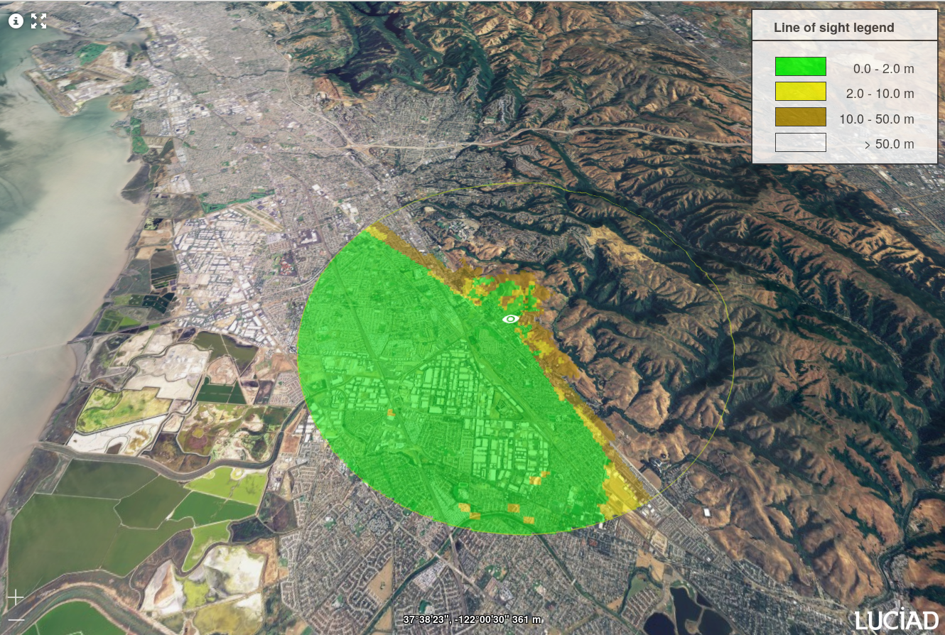
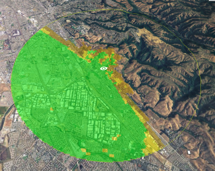
This service provides a visibility calculation from a person's point of view.
The calculation is based on a digital terrain model.
The result of the calculation provides information on what may be visible when looking around from the given location.
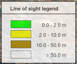
- Objects with a size smaller than 2m may be visible, eg, you can see other persons.
- Objects with a size smaller than 10m may be visible, eg, houses, trees, etc.
- Objects with a size smaller than 50m may be visible, eg higher buildings, churches, etc.
Actual values and colors used by the service to interpret the result are available in a legend.
Example use of line of sight calculation within a client application.
Example use of legend for line of sight calculation within a client application.
Input
- Center point, expressed in WGS84.
- Radius of the calculation around the center point, expressed in meters.
- Output CRS of the LOS image result, expressed using EPSG or CRS formatting.
Output
PNG image with the calculated LOS image.
Fixed parameters within the service
The service uses a set of parameters that cannot be provided by the client application to keep the API simple.
The following values are being used:
- Height of the observer at the center location: 2 meters.
- 360 degrees coverage with 3 degrees angle step size.
- 40 terrain samples per angle direction.
- Image size of 400x400 pixels.
- The area of interest (circle) is fitted within the view.
Error conditions
- Circle radius is limited to a maximum value to protect the service from memory and CPU overload.
The minimum and maximum radius values are included in the error message.
By default the range of the radius is between 1000m and 50000m.
- Unknown EPSG or CRS code.
- Internal configuration error (no elevation data). Reported to user without details.
End point
/samples/fusion/tea/elevation/los
Request line of sight
- POST:
- Request mime-type:
application/json
- Request body:
application/json
      {
      "longitude": -122.04,
      "latitude": 37.63,
      "radius": 5000.0,
      "responseCRS": "EPSG:4326"
      }
Responses:
- Valid request:
- Content: PNG with result of Line of Sight calculation.
- Status code:
200
- Mime-type:
image/png
- Invalid request parameters:
- Content: message with info on what is wrong/expected.
- Status code:
400
- Mime-type:
text/plain
- Server configuration error:
- Content: message there is a (configuration) issue on the server but without details.
- Status code:
500
- Mime-type:
text/plain
Request bounds
Response
- Content: This returns the bounds of the Line of Sight calculation, expressed in the response CRS.
- Status code:
200
- Mime-type:
application/json
Request legend
Response
- Content: entries that contain the object sizes that you may see and which color is associated with them.
- Status code:
200
- Mime-type:
application/json
Versioning
All services mentioned here require a request parameter indicating the desired version of the service.
At this moment only version 1.0 is available.